Business Details
46 Years
experience
Professional Land Surveying & Civil Engineering Services in Red Wing, MN
Founded in 1980, Johnson & Scofield has built a reputation for delivering precise, reliable land surveying and civil engineering solutions across Minnesota and Wisconsin. Our team of licensed professionals combines decades of experience with advanced technology to provide boundary surveys, topographic mapping, flood elevation certifications, and comprehensive civil engineering designs. With offices in Red Wing, Hastings, Wabasha, and Winona, we prioritize personalized service, ensuring every client receives tailored attention regardless of project scale. Our commitment to accuracy and client satisfaction has made us a trusted partner for residential, commercial, and municipal projects since our inception.We specialize in resolving boundary disputes, supporting infrastructure development, and offering ALTA/ACSM surveys for commercial real estate transactions. By maintaining a small-town approach to client relationships, we ensure clear communication and prompt service while adhering to the highest industry standards. Our engineers and surveyors collaborate closely with clients to address drainage challenges, subdivision requirements, and construction staking needs, delivering actionable data that informs critical decisions. With over 40 years of combined expertise in our leadership team, we continue to serve as a cornerstone resource for land development and engineering solutions in the Upper Midwest.

Services
Land Surveying
Civil Engineering
Boundary Surveys
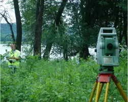
Topographic Surveys
Flood Surveys
Subdivision Platting
ALTA/ACSM Surveys
Construction Staking
As-Built Surveys
Hydraulic Analysis
Details
- Year established: 1980
Highlights and features
- We have over 40 years of combined experience in land surveying and civil engineering.
- Our team provides ALTA/ACSM surveys meeting national commercial real estate standards.
- We offer flood elevation certifications that help clients avoid unnecessary insurance costs.
- Our engineers design infrastructure solutions for roads, utilities, and drainage systems.
- We maintain four local offices to ensure prompt service across Minnesota and Wisconsin.
Services
Boundary Surveys
Our boundary surveys establish precise property lines using historical records and field data. We install iron monuments and visible markers to document corners, resolve disputes, and support real estate transactions. Clients receive a Certificate of Survey detailing acreage, encroachments, and legal descriptions. This service ensures compliance with state regulations and protects property rights.
Flood Elevation Certificates
We conduct flood elevation surveys to determine if structures meet FEMA base flood requirements. Our reports document vertical elevations and land contours, enabling clients to request LOMAs for flood zone removal or secure accurate insurance premiums. This service helps homeowners and lenders mitigate flood risk exposure through certified data.
Civil Engineering Design
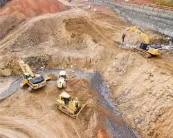
Our civil engineers create construction drawings for roads, utilities, and drainage systems. We develop grading plans, perform hydrologic analysis, and manage project specifications from concept to completion. This service includes on-site inspections and material testing to ensure compliance with municipal codes and project requirements.
Topographic Surveys
We produce detailed topographic maps showing elevation contours, buildings, utilities, and natural features. These surveys support site planning, drainage analysis, and construction projects. Our team collaborates with clients to define survey specifications, ensuring cost-effective data collection that meets engineering and architectural needs.
Subdivision Platting
We assist with subdividing land through preliminary and final plat preparation. Our services include boundary analysis, utility planning, and zoning compliance documentation. We coordinate with county officials to secure approvals and install physical monuments, ensuring legal compliance for both minor and major subdivisions.
People
Marcus Johnson
Office Manager
Marcus Johnson oversees operations at our Red Wing office. As a licensed surveyor, he ensures quality control and client satisfaction for boundary and construction surveys. With over 20 years in the field, he specializes in resolving property disputes and managing complex land development projects.
Scott Bechel
Office Manager
Scott Bechel manages our Wabasha office and holds a Wisconsin land surveyor license. He focuses on flood elevation certifications and topographic mapping, supporting both residential and municipal clients. His expertise includes FEMA compliance and drainage analysis for rural properties.
Mitch Scofield
Office Manager
Mitch Scofield leads the Hastings office team. His work emphasizes subdivision platting and ALTA/ACSM surveys for commercial real estate transactions. With 15+ years of experience, he specializes in coordinating large-scale projects requiring precise boundary documentation and zoning compliance.
Brian Wodele
Office Manager
Brian Wodele manages survey operations in Winona. He specializes in construction staking and as-built surveys for infrastructure projects. His background includes utility design and field data collection, ensuring accurate implementation of engineering plans for municipal and private clients.
Questions
When do I need a land survey?
You need a land survey when buying/selling property, building near property lines, resolving boundary disputes, or applying for mortgages/flood insurance. We recommend surveys for any major land transaction or improvement.
What services do you offer?
We provide boundary surveys, topographic mapping, flood elevation certifications, subdivision platting, ALTA/ACSM surveys, construction staking, and civil engineering design for infrastructure projects.
Do you serve areas outside Minnesota?
Yes, we serve Wisconsin and provide services in Rochester, MN through our regional office. Our main offices in Red Wing, Hastings, Wabasha, and Winona cover most of southeastern Minnesota.
What is an ALTA/ACSM survey?
An ALTA/ACSM survey is a detailed commercial property survey showing boundaries, easements, improvements, and zoning compliance. Required by lenders and title insurers, it provides comprehensive data for real estate transactions.
Can you help remove my property from a flood zone?
Yes. We conduct flood elevation surveys and submit LOMA requests to FEMA. If our data proves your structure exceeds base flood elevation, we can help eliminate mandatory flood insurance requirements.
Reviews (2)
Jim Bono
Mar 10, 2022
Report
Great customer service, excellent communication, timely response to the job. Definitely would recommend Wabasha location!
Ls W.
Apr 28, 2017
Report
We do NOT recommend this company. They did not inform us that they were planning to come onto our private property. When they showed up they did not let us know they were here. They admitted they should have come talk to us to let us know they had come and what they were going to do but they didn't even try.