Business Details
50+ Years
experience
Trusted Land Surveyors in Lebanon, PA
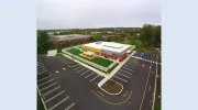
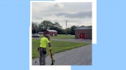
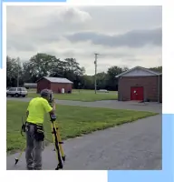
Since 1969, Matthew & Hockley Associates has provided engineering and land surveying services in Lebanon County, Pennsylvania. Our team of registered surveyors, sewage enforcement officers, and technicians specialize in property surveys, topographical mapping, and construction stakeout. We utilize advanced equipment including GPS systems and AutoCAD technology to ensure precision and efficiency. As part of Chrisland Engineering since 2023, we combine decades of local expertise with multidisciplinary resources. Our staff includes licensed engineers, drafters, and specialists in stormwater management and on-lot sewage design.We serve residential, commercial, industrial, and municipal clients across Lebanon County. Our field crews conduct soil percolation tests and property stakeouts, while our office ensures fast turnaround times. R. Scott Carpenter leads our soils department, applying DEP-approved methodologies for sewage systems. We maintain a commitment to quality service and community development through accurate surveying and engineering solutions. Our legacy of trust spans over 50 years, supporting safe and successful real estate projects in the region.

Services
Land Subdivision Design
Topographical Surveys
Property Surveys
Storm Water Management
Percolation Tests
Flood Insurance Studies
Construction Stakeout
Sewage Disposal Design
Details
- Year established: 1969
Highlights and features
- We have over 50 years of experience in Pennsylvania land surveying.
- Our team uses advanced GPS and AutoCAD technology for accuracy.
- We offer combined expertise through Chrisland Engineering's resources.
- Our staff includes specialists in sewage system design and DEP protocols.
- We provide fast turnaround times with three dedicated AutoCAD stations.
Services
Land Subdivision Design
We create detailed land subdivision plans for residential and commercial developments. Our team ensures compliance with local regulations while optimizing land use. Clients benefit from precise boundary definitions and infrastructure planning.
Topographical Surveys
Our topographical surveys capture natural and man-made features for construction projects. Using GPS technology, we deliver accurate elevation data. This service supports site analysis and design planning for developers and engineers.
Flood Insurance Studies
We conduct flood elevation studies to determine insurance requirements. Our certified surveyors provide FEMA-compliant documentation. Homeowners and businesses use these reports to obtain accurate flood insurance coverage.
Construction Stakeout
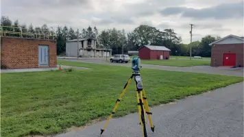
Our crews perform precise property stakeouts during construction. GPS technology ensures accurate placement of structures. This service prevents costly errors during building and development projects.
Sewage Disposal Design
We design on-lot sewage systems following DEP guidelines. Our specialists evaluate soil conditions for optimal waste management. This service ensures environmental compliance for rural properties and developments.
People
R. Scott Carpenter
Sewage Enforcement Officer
Leads our soils department with expertise in DEP-approved sewage system design. Specializes in small flow treatment plants and wetland discharge solutions for agricultural and residential properties.
Josh Weaber
P.E.
Licensed professional engineer overseeing civil engineering projects. Brings technical expertise to infrastructure and development planning within Lebanon County's regulatory framework.
Russell D. Frantz
P.L.S.
Professional land surveyor managing boundary determinations and mapping projects. Applies advanced GPS technology to ensure precise property documentation for residential and commercial clients.
Questions
What surveying services do you offer?
We provide property surveys, topographical mapping, land subdivision design, flood elevation studies, construction stakeout, and sewage disposal system planning.
Do you serve residential clients?
Yes, we handle single-lot subdivisions, flood insurance studies, and property surveys for homeowners in Lebanon County.
What technology do you use?
Our field crews use GPS systems and electronic total stations. Office operations include three AutoCAD stations for efficient data processing and plan creation.
Are you licensed in Pennsylvania?
Yes, we employ registered surveyors and licensed engineers certified to work throughout Pennsylvania.
How quickly can you complete a survey?
Turnaround time varies by project complexity, but our AutoCAD systems and experienced staff ensure efficient completion of most assignments.
Reviews (1)
Kurt
Jun 13, 2022
Report
Ended up with different surveyor only because I had contacted them earlier, but these folks answered the phone and talked with me right away. That seems to be a rarity these days. I think they are good folks to work with.