Business Details
31 Years
experience
Expert Civil Engineering and Land Surveying Services in Tulsa
Established in 1995, Sisemore & Associates has built a reputation as a trusted provider of civil engineering, land surveying, and land planning services across Oklahoma. Our team of licensed professionals combines decades of experience with state-of-the-art technology to deliver accurate, reliable solutions for residential, commercial, and industrial projects. We prioritize collaboration, utilizing a team-based approach to ensure every project meets client needs while adhering to strict quality standards. With four licensed land surveyors and a professional civil engineer on staff, we offer comprehensive expertise in storm sewer design, topographic surveys, and construction layout.Our commitment to innovation and precision has earned the trust of state agencies, municipalities, and private clients. We maintain active involvement in community development through membership in the Tulsa Regional Chamber and support for local initiatives. Our services span from initial consultation to final as-built documentation, ensuring seamless project execution. The firm's 30-year history reflects our dedication to advancing engineering practices while maintaining personalized client relationships.


Services
Civil Engineering
Land Surveying
Land Planning
3D Laser Scanning
UAV Mapping
Construction Layout
Details
- Year established: 1995
Highlights and features
- We have over 25 years of experience in Oklahoma's civil engineering sector
- Our team includes four licensed land surveyors and professional civil engineers
- We utilize state-of-the-art technology for surveying and engineering projects
- We offer comprehensive services from initial consultation to final documentation
- Our firm maintains active involvement in Tulsa regional development initiatives
Services
Civil Engineering
Our civil engineering team delivers comprehensive site design solutions for residential subdivisions, commercial developments, and campus projects. With decades of combined experience, we create integrated designs that address stormwater management, utility systems, and infrastructure requirements. Our engineers collaborate closely with surveyors and planners to ensure projects meet regulatory standards while optimizing functionality and cost-effectiveness.
Land Surveying
We provide precise land surveying services using advanced technology for boundary determination, topographic mapping, and construction staking. Our team performs ALTA/NSPS surveys, boundary surveys, and as-built documentation. With four licensed surveyors on staff, we ensure accurate data collection that forms the foundation for successful development projects across Oklahoma.
3D Laser Scanning
Our 3D laser scanning technology captures detailed spatial data for pre-design analysis and as-built documentation. This advanced method produces accurate 3D models and volumetric calculations that enhance project planning. The technology improves efficiency in surveying complex structures and large sites while maintaining exceptional measurement precision for engineering applications.
Land Planning
We create cost-effective land planning solutions that balance development needs with environmental considerations. Our planners collaborate with engineers and surveyors to design functional spaces for commercial, residential, and mixed-use developments. Services include zoning assistance, feasibility studies, and GPS survey integration to optimize land use while meeting regulatory requirements.
UAV Mapping
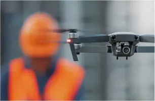
Our UAV (Unmanned Aerial Vehicle) mapping services collect high-resolution aerial data for topographic and planimetric surveys. This technology enables rapid data collection across large areas, improving project efficiency and accuracy. The detailed aerial measurements support site analysis, progress monitoring, and final documentation for various engineering and surveying applications.
People
Shawn Collins
President
President and licensed Professional Land Surveyor with over 30 years of experience in Oklahoma's surveying industry. Recognized as 2024 Tulsa Small Business Person of the Year and 2025 Oklahoma Small Business Person of the Year. Leads firm strategy and client relationships.
Kelly Schmidt
Registered Land Surveyor
Experienced land surveyor with expertise in boundary determination and construction staking. Provides technical leadership for surveying projects across Oklahoma. Collaborates with engineering and planning teams to ensure accurate field data collection and analysis.
Ron Leifheif
Registered Land Surveyor
Licensed surveyor specializing in ALTA/NSPS surveys and legal boundary documentation. Contributes technical expertise to complex land development projects. Works closely with clients to deliver precise surveying solutions that meet regulatory requirements and project specifications.
Jimmie Hendrickson
Project Manager
Project manager overseeing engineering and surveying operations. Coordinates cross-functional teams to ensure timely project delivery. Brings extensive experience in managing civil infrastructure projects from initial planning through final implementation phases.
Kristie O'Brien
Project Manager
Experienced project manager coordinating land planning and development initiatives. Focuses on client communication and project execution. Ensures alignment between technical requirements and client objectives while maintaining compliance with regulatory standards.
Questions
What civil engineering services do you offer?
We provide comprehensive civil engineering services including site design, stormwater management, utility systems, and infrastructure planning for residential, commercial, and industrial projects.
Do you provide land surveying services in Oklahoma City?
Yes, we offer professional land surveying services throughout Oklahoma, including boundary surveys, ALTA/NSPS surveys, and construction staking in Oklahoma City and surrounding areas.
What is your experience with land planning?
Our team has extensive land planning experience including zoning assistance, feasibility studies, and GPS survey integration for commercial, residential, and mixed-use developments across Oklahoma.
How does your 3D laser scanning improve projects?
Our 3D laser scanning technology captures precise spatial data, creating detailed models that enhance design accuracy and reduce field rework during engineering and surveying projects.
Can you perform UAV mapping for large sites?
Yes, we use UAV technology to collect aerial data for topographic surveys, improving efficiency and accuracy when mapping large or complex sites for engineering applications.
Reviews (4)
Brettine Kimmel
May 15, 2022
Report
They have the best customer service! If your looking for a surveying company that is always knowledgeable and willing to help then this is the place for you!
John Mozingo
Sep 25, 2021
Report
Sisemore & Associates are experts in their field! They are quick to help you with your project and have excellent communication skills. They have the answers to questions you don't even know to ask. The professional staff is dedicated to accuracy which is extremely important in my field. I have used Sisemore & Associates lots of times on my projects over the years. They are the only ones I would recommend!
Deren Ertugrul
Jul 20, 2021
Report
I have worked with this firm on various projects over the years and it is always a pleasure. Their level of service and efficiency is top notch.
Isaac Bell
Jul 05, 2021
Report
Worked with them for years and our experience is; they've always been on time, usually under budget and extremely professional. You won't pay them to "learn on your job", they know what they are doing and can back everything up.