
Business Details
20 Years
experience
Trusted Civil Engineering and Land Surveying Services in Pennsylvania
The Crossroads Group is a full-service civil engineering, land surveying, and telecommunications design firm with over 18 years of experience serving clients across the Mid-Atlantic and Midwest regions. Founded in 2006, our company has built a reputation for delivering high-quality engineering solutions while maintaining a deep understanding of evolving municipal codes and state regulations. Our team combines technical expertise with practical problem-solving to minimize project delays and costs for residential developers, commercial enterprises, energy companies, and telecommunications providers. We specialize in stormwater management, zoning compliance, FAA certifications, and regulatory permitting, including Chapter 102 and 105 approvals.With professional licenses in six states and expertise spanning over 30 counties, we provide tailored solutions that balance technical precision with client-specific needs. Our commitment to continued education ensures compliance with the latest engineering methodologies while maintaining the personalized service that distinguishes us from larger firms. Through strategic office locations in Pennsylvania and a team of FAA-certified drone operators, we combine local knowledge with innovative technology to deliver accurate data and efficient project outcomes. Our culture of collaboration extends to both employees and clients, fostering long-term relationships built on trust and technical excellence.
Services
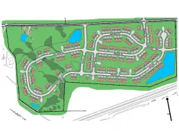
Land Development
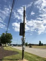
Telecom Services
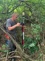
Survey
Drone Services
Construction Plans
Chapter 102 Permitting
Chapter 105 Permitting
A/E Telecom Design
County Permits
FAA Certifications
Details
- Year established: 2006
Highlights and features
- We have over 18 years of experience in civil engineering and land surveying
- Our team provides efficient municipal approval processes in 30+ counties
- We offer services across six states with active professional engineering licenses
- Our FAA-certified drone operators enhance survey accuracy and data collection
- We guarantee expedited permitting through established regulatory agency relationships
Services
Land Development
Our land development services encompass stormwater management, grading plans, and construction design for commercial and residential projects. We specialize in minimizing permitting delays through established relationships with municipal agencies while ensuring compliance with environmental regulations. Our team delivers cost-effective solutions that balance site requirements with regulatory constraints across multiple jurisdictions.
Telecom Services
We provide comprehensive A/E telecom solutions including site surveys, lease exhibits, and zoning plans for tower and small cell deployments. Our expertise spans carrier-specific designs, NEC clearance analysis, and FAA certifications. With over 400 small cell projects completed in Pennsylvania, we combine technical precision with rapid turnaround for wireless infrastructure projects.
Chapter 102 Permitting
Our Chapter 102 permitting specialists maintain active coordination with PADEP regional offices to secure erosion and sedimentation control permits efficiently. We stay current with regulatory changes to ensure compliance while protecting project timelines, with expertise in wetland and groundwater recharge designs for both private and public sector clients.
Survey Services
We offer topographic, boundary, and ALTA/ACSM surveys with construction stakeout and title review services. Our surveyors combine traditional techniques with modern technology, including drone-based photogrammetry, to deliver precise data for land development projects, utility corridors, and property line determinations across diverse terrain.
Drone Services
Our FAA-certified drone operators capture high-resolution aerial data for construction monitoring, material tracking, and site analysis. This technology enhances traditional survey methods by providing comprehensive site documentation, 3D modeling, and progress tracking capabilities that improve project accuracy and decision-making.
People
Jeremiah D. Hoagland
President
Co-founder with 18+ years of civil engineering experience, overseeing all business operations while maintaining active project involvement. Holds BS in Civil Engineering from Wilkes University and licenses in multiple states.
Joshua D. Hoagland
Vice President
Licensed Professional Engineer with expertise in stormwater management and zoning compliance across multiple states. Graduated from Johns Hopkins with civil engineering degree and entrepreneurial training.
Ron Bobiak
VP, Director of A/E Services
Telecom industry veteran with 15+ years of experience in wireless network deployment and site acquisitions, specializing in project management and cross-disciplinary team leadership for large-scale infrastructure projects.
Becky Grant
Director, Real Estate Services
Telecom real estate expert with decade of experience in site development for major carriers, combining engineering knowledge with entitlement strategies to secure project approvals efficiently.
Matt Young
Design Lead / CAD Manager
20-year CAD design specialist with expertise in architectural drafting, civil engineering, and 3D modeling, overseeing drafting standards and software implementation for engineering deliverables.
Questions
What areas do you provide engineering services in?
We serve Pennsylvania, Delaware, Ohio, New York, West Virginia, and six other Mid-Atlantic and Midwest states with engineering, surveying, and telecom design solutions.
Do you handle stormwater management projects?
Yes, our civil engineers specialize in stormwater management systems and erosion control plans compliant with Chapter 102 regulations across multiple jurisdictions.
Can you assist with wireless site permitting?
We provide complete FAA certifications, zoning plans, and carrier-specific designs for telecom towers and small cell deployments with proven approval success.
Do you offer drone survey services?
Yes, our FAA-certified drone operators provide aerial data collection for construction monitoring, site mapping, and 3D modeling to enhance traditional survey methods.
How do you handle multi-state projects?
With professional licenses in six states and experience in over 30 counties, we coordinate cross-jurisdictional permitting while maintaining local code compliance expertise.
What survey services do you offer?
We provide topographic, boundary, ALTA/ACSM, construction stakeout, and floodplain surveys using both conventional methods and drone technology for enhanced accuracy.
Reviews (1)
Barry
Jun 27, 2011
Report
The company owners like to steal your clients from your business. Be very carefull in dealing with these people! They lore the clients in on cheap business and do a hack job. Just watch how they slam you in extra fees due to not getting plans right the first time.