
Business Details
Your Trusted Land and Hydrographic Surveying Experts in Oregon
At Statewide Land Surveying, we bring over 15 years of expertise in navigating the Pacific Northwest's challenging terrain and waterways to deliver precise, timely surveying solutions. Our services integrate advanced technologies like single-beam sonar for hydrographic surveys and UAVs for aerial mapping, ensuring high accuracy at competitive costs. We specialize in ALTA surveys, boundary delineation, environmental assessments, and habitat restoration projects, tailored to meet the unique demands of both land and aquatic environments. Our field staff, equipped with in-house survey vessels, operates efficiently in lakes, rivers, and shallow waters in Oregon and Washington. We prioritize continuous staff training and investment in cutting-edge tools to maintain industry-leading standards while adhering to realistic budgets.Our approach emphasizes safety, with a proven record of zero lost-time accidents among our team. Committed to a customer-centric philosophy, we adapt swiftly to project changes and maintain rigorous quality control throughout every phase of our work. Our dedication to excellence is reflected in the seamless integration of terrestrial, aquatic, and aerial data, ensuring comprehensive solutions for complex surveying challenges. We serve diverse sectors including construction, environmental restoration, and land development, leveraging decades of local market knowledge to exceed client expectations. Our legacy of precision and reliability has established us as a trusted partner for surveying needs across the Pacific Northwest.
Services
ALTA Surveys
Hydrographic Surveys
UAV Mapping
Habitat Restoration
Topographic Surveys
Boundary Delineation
Environmental Assessments
GPS Data Collection
Flood Certification
Construction Layout
Highlights and features
- We have 15+ years of experience navigating Northwest waterways for hydrographic surveys
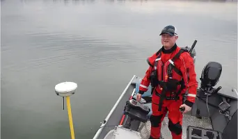
- Our in-house survey vessels operate in shallow waters, lakes, and riverine environments
- UAV technology enables cost-effective aerial mapping and 3D imagery solutions
- Continual staff training ensures expertise with the latest surveying tools and techniques
- Proven safety record with zero lost-time accidents among our survey teams
Services
Hydrographic Surveying
Using single-beam sonar technology, we conduct detailed bathymetric surveys for lakes, rivers, and coastal areas. Our experienced team captures precise underwater topography data that integrates seamlessly with terrestrial surveys. With specialized vessels for shallow waters, we deliver cost-effective solutions for environmental assessments and infrastructure projects in Oregon and Washington's waterways.
UAV Surveying
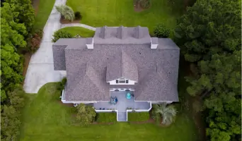
Our survey-grade drones provide high-resolution aerial mapping and 3D modeling for large-scale projects. This technology enables efficient data collection in difficult terrain while maintaining survey-grade accuracy. We generate point cloud data and photogrammetry models that reduce costs compared to traditional aerial surveys, supporting construction planning and environmental monitoring applications.
Habitat Restoration
We provide baseline data collection and progress monitoring for environmental restoration projects. Our surveys support habitat rehabilitation efforts by documenting existing conditions and tracking ecological improvements. Combining terrestrial and aquatic data collection methods, we help clients meet regulatory requirements while ensuring measurable environmental benefits in Pacific Northwest ecosystems.
Land Surveying
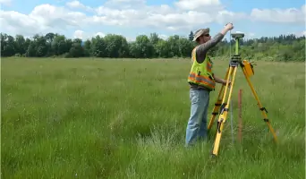
From property boundary determination to construction layout, our land survey services address diverse needs across Oregon and Washington. We perform ALTA surveys, topographic mapping, and cadastral surveys using advanced GPS and geodetic techniques. Our team handles complex projects like hospital site staking while maintaining strict accuracy standards for legal and development purposes.
Topographic Surveys
We create detailed elevation models of project sites using conventional and GPS-based survey methods. These topographic surveys support engineering design, floodplain analysis, and environmental impact assessments. Our team works efficiently in challenging terrain, delivering accurate data for land development projects and infrastructure planning throughout the Pacific Northwest region.
Questions
What geographic areas do you serve for surveying projects?
We primarily serve Oregon and Washington states, including urban, rural, and coastal environments throughout the Pacific Northwest region.
What technologies do you use for survey data collection?
We utilize single-beam sonar for hydrographic surveys, UAV drones for aerial mapping, and GPS/total station systems for terrestrial surveys.
How do you handle complex terrain or challenging survey environments?
Our equipment includes specialized vessels for shallow water surveys and drones for accessing difficult terrain. Our staff has over 15 years of experience navigating Pacific Northwest conditions.
What differentiates your surveying services from competitors?
Our combination of water/land survey capabilities, in-house vessel fleet, UAV technology, and local expertise provides comprehensive solutions that integrate multiple data sources for superior accuracy.
How do you ensure data accuracy across different survey types?
We employ standardized workflows and advanced software to integrate hydrographic, topographic, and UAV data into unified project deliverables with consistent accuracy standards.
Reviews (6)
Tobaj Music
Dec 12, 2021
Report
These folks did a fantastic and very professional level job. Their bid for a full survey (registered with the county - with digital and hard copies provided to me) - came in much lower than the "competition" for the same service. Greg was super nice and easy-going from the start - but very professional and prompt in their assessment. They continued to give good service even after completion to help us make sure our property boundary was clear for our contractors - to make sure we don't infringe on our neighbor's property. Thanks again to Greg and the whole team for a job well-done! Todd Gang
Andrew Smith
Dec 06, 2021
Report
I called to ask a bunch of questions and the woman who answered the phone was very knowledgeable and helpful. Greg called me back very quickly and proposed an alternate solution that would save me time and money. All this during a time when most surveyors I've contacted don't answer the phone or return calls (I assume they're all very busy right now). Very impressed, would highly recommend
Josh Hall
Oct 25, 2021
Report
This company took the time out of their day to discuss survey findings from 2008 done on the home I purchased recently. They also went above and beyond to give me information regarding a survey done on the adjacent property in order to help with my property line search. A huge help!
Kirk Pearson
Jun 18, 2021
Report
We had SWLS survey our timber boundary & we had a positive experience working with them. They are responsive and provided a complete description of the work they were performing. All the staff we had contact with were professional and knowledgeable of our job, I would use them again.
Alessandra Ricci
Dec 02, 2020
Report
This company was recommended to me from a friend and I can see why. They were very prompt in replying to my emails. I received clear explanation to all of my questions and completed the job earlier than predicted. They were organized, punctual, flexible in meeting my schedule needs, had great professional gear and were accurate and thorough. It was a pleasure working with them. I highly recommend them.
D. Curtiss
Jan 01, 2020
Report
I was looking to get a Meets and Bounds done for an easement between my neighbor and I. Greg first told me his lead time and then looked up who plotted my land so he could refer me to the company that already had my boundary info to get me the cheapest cost. I would highly recommend Statewide. I appreciate their honesty and they're willingness to help someone he doesn't ever know.