
Business Details
Your Precision Geospatial Surveying Partner in Marlette
Muxlow Surveying is an experienced small business dedicated to delivering precision geospatial surveying and mapping services across Michigan and the Great Lakes Region. With certifications including Woman-Owned Small Business (WOSB), MDOT Disadvantaged Business Enterprise (DBE), and MDOT Prequalified status, we serve diverse clients ranging from local residents to Fortune 500 companies and government agencies. Our licensed surveyors operate in six states and employ advanced technologies like UAV mapping, mobile LiDAR, and hydrographic surveys to address complex projects in boundary delineation, transportation infrastructure, energy development, and federal initiatives.Our team combines technical expertise with a commitment to humanitarian and social projects, ensuring clients receive tailored solutions backed by decades of combined industry experience. We prioritize collaboration, maintaining partnerships with engineering firms while upholding rigorous safety standards through staff certifications in OSHA training and CPR. Our multidisciplinary approach spans sectors including nuclear sites, wind farms, state forests, and municipal infrastructure, reflecting our adaptability to both routine and specialized surveying challenges.
Services
Boundary Surveys
Geospatial Services
Transportation Mapping
Energy Sector Surveys
Commercial Surveys
Federal Project Surveying
Hydrographic Surveys
UAV Mapping
State Forest Boundary Surveys
Subsidence Monitoring
Highlights and features
- We are a certified Woman-Owned Small Business (WOSB) with MDOT DBE status
- Our team holds OSHA and American Heart Association safety certifications
- We operate advanced technologies including UAV and LiDAR mapping systems
- We maintain professional surveyor licenses across six Midwestern states
- We serve both public and private sectors with specialized federal expertise
Associations and certifications
- Woman-Owned Small Business (WOSB)
- MDOT DBE Certified
- MDOT Prequalified
- Certified Survey Technicians (Levels I, IV)
What people say
Exceptional technical accuracy
Responsive service
Reliable project delivery
Great work again
Hats off to staff
Services
Boundary Surveys
Our boundary surveys establish precise property lines using cadastral methods, easement creation, and legal description preparation. We handle residential divisions, farm land surveys, and complex federal boundary adjudications. Our team participates in mediation and expert witness roles for boundary disputes.
Mobile LiDAR Mapping
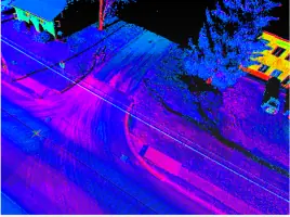
Mobile LiDAR services create detailed 3D models of transportation corridors and infrastructure. Our Leica Pegasus2 system captures roadway geometrics and planimetric data for MDOT and airport design projects while maintaining safety standards during active road operations.
Hydrographic Surveys
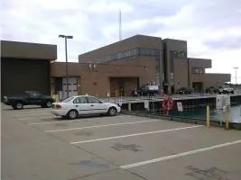
Hydrographic and bathymetric surveys map underwater topography using manned and unmanned vessels. Applications include coastal erosion assessments, port infrastructure planning, and environmental monitoring for Great Lakes and inland waterway projects.
UAV Mapping
Unmanned Aerial Vehicle (UAV) mapping captures high-resolution aerial data for topographic surveys and construction monitoring. Compliance with FAA regulations ensures safe data collection in challenging environments like nuclear facilities and state prisons.
Federal Surveys
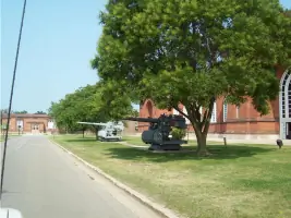
Federal surveying services include DODEA school sites, NAVFAC installations, and USACE real estate digitization. Our team meets strict federal specifications for NRCS easements, military base mapping, and national security-related boundary assessments.
People
Tricia Muxlow
President | CEO
Licensed professional surveyor with over 25 years of experience leading geospatial projects across the Midwest. Specializes in federal contract compliance and advanced surveying technologies.
Roberta Hardy
Office Manager | Project Coordinator
Manages project logistics and client communications with 15+ years of experience in geospatial business operations. Ensures timely execution of complex multi-state survey campaigns.
Ron Meyer
Senior Crew Chief
Certified Survey Technician (Level IV) overseeing field operations and data collection. Maintains equipment calibration standards and supervises survey crews in hazardous environments.
Mark Lieber
Survey Technician
Field technician specializing in terrestrial scanning and robotic survey equipment operation. Holds OSHA 40-hour HAZWOPER certification for industrial site assessments.
Tom Yaroch
Asset Security
Security specialist implementing data protection protocols for sensitive surveying information and maintaining physical security for field equipment and documentation.
Questions
What geographic areas do you serve?
We operate across Michigan, the Great Lakes Region, and the Midwest US with licensed surveyors in six states. Our federal projects reach nationwide locations.
What surveying technologies do you use?
We employ UAV mapping, mobile LiDAR, terrestrial scanning, and robotic equipment while maintaining traditional boundary surveying techniques for comprehensive project solutions.
Are you certified for government contracts?
Yes, we hold Woman-Owned Small Business (WOSB) designation, MDOT DBE certification, and MDOT Prequalified status for transportation and right-of-way survey services.
How do you handle challenging environments?
Our team conducts surveys in hazardous locations including nuclear sites and confined spaces, utilizing OSHA-certified safety protocols and specialized equipment configurations.
Can you assist with federal project requirements?
We specialize in federal geospatial projects including DODEA schools, USACE real estate mapping, and NAVFAC infrastructure assessments meeting stringent government specifications.
