
Business Details
46 Years
experience
Emergency
services
Your Trusted Partner for Surveying Solutions
Morris P Hebert has provided professional surveying, engineering, and environmental services since 1980, combining experienced personnel with state-of-the-art technology to deliver client-focused solutions. Our expertise spans turn-key project management, high-definition laser scanning, unmanned aerial systems, and geographic information systems, addressing complex challenges in surveying and construction. Headquartered in Houma, LA, with offices in Houston and Midland, TX, we prioritize safety, environmental protection, and rapid response to project demands. Our commitment to innovation includes FAA-certified UAS operations, advanced LiDAR data collection, and compliance with federal and state regulations.With decades of experience, we serve industries such as oil & gas, renewable energy, and coastal restoration, maintaining a track record of successful project execution. Our team emphasizes cost-effective solutions, technical precision, and adherence to project timelines, supported by strategic partnerships and industry-specific accreditations. We foster a culture of integrity, education, and hard work, ensuring client satisfaction through transparent communication and tailored service offerings.

Services
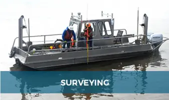
Surveying
Remote Sensing
UAS Operations
HD Laser Scanning
Confined Space Inspection
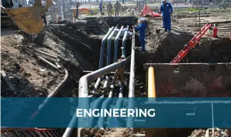
Engineering
GIS
Environmental Services
Details
- Year established: 1980
Highlights and features
- We offer FAA-certified UAS pilots with thousands of flight hours.
- Our team utilizes state-of-the-art LiDAR and photogrammetry technology.
- We provide turn-key project management from conception to completion.
- Our commitment to safety includes strict adherence to FAA regulations.
- We maintain strategic offices in Louisiana and Texas for regional coverage.
Associations and certifications
- FAA Part 107
Services
Unmanned Aerial Systems (UAS)
Our FAA-certified UAS operations collect high-resolution LiDAR, photogrammetry, and thermal data for pipeline inspections, disaster recovery, and land surveys. With advanced sensors and 4K video capabilities, we enable rapid data acquisition in hazardous or inaccessible areas. Clients benefit from reduced field time, enhanced safety, and precise 3D modeling for infrastructure planning.
High Definition Laser Scanning
HDLS technology captures survey-grade 3D models of facilities, pipelines, and historical sites with 1-3cm accuracy. We process point clouds into BIM models for clash detection, dimensional control, and historical preservation. This non-invasive method minimizes site revisits, improves project timelines, and supports asset management for oil & gas and construction clients.
Confined Space Inspection
Our specialized UAVs conduct safe, efficient inspections of tanks, pipelines, and industrial chimneys without exposing personnel to hazards. Equipped with infrared cameras and LED illuminators, these drones capture high-resolution imagery in low-visibility environments. This service reduces downtime and costs while ensuring compliance with safety regulations in offshore and onshore facilities.
Pipeline Engineering
We offer full-cycle pipeline engineering, from route analysis and HDD design to terminus facility planning. Our team manages regulatory permitting, environmental compliance, and construction oversight for oil & gas and renewable energy projects. Clients receive cost-effective, code-compliant solutions optimized for challenging terrains and timelines.
Geographic Information Systems
As an ESRI partner since 2001, we develop enterprise GIS systems for municipal planning, environmental monitoring, and asset management. Our services include data modeling, spatial analysis, and web-based mapping platforms. Clients gain actionable insights for infrastructure projects, disaster response, and regulatory reporting across multiple industries.
People
Morris P Hebert
Chairman of the Board
Founder with over 40 years of experience in surveying and engineering, leading strategic growth since 1980. Advocates for technological innovation and client-centric solutions.
Brian P. Hebert
coCEO
Co-leads operations with expertise in project management and regulatory compliance. Focuses on expanding UAS and HDLS capabilities for complex infrastructure projects.
John M. Hebert
coCEO
Co-manages daily operations, emphasizing safety protocols and client relations. Drives advancements in GIS and environmental permitting services.
Questions
What industries does Morris P. Hebert serve?
We serve oil & gas, renewable energy, coastal restoration, electrical transmission, port facilities, and federal agencies with specialized surveying and engineering solutions.
Do you offer emergency response services?
Yes, our UAS and HDLS teams provide rapid disaster recovery assessments, including post-storm infrastructure inspections and emergency pipeline evaluations.
What certifications do your UAS pilots hold?
All pilots are FAA Part 107 certified with thousands of commercial flight hours, adhering to strict safety and operational compliance standards.
Can you handle large-scale pipeline projects?
Yes, we've managed pipelines exceeding 100 miles in length, offering route analysis, HDD design, and regulatory permitting from conception to completion.
What GIS software platforms do you use?
We specialize in ESRI's Local Government Model and develop custom GIS systems for municipal planning, asset management, and environmental compliance reporting.
How do you ensure project safety?
Our safety program includes FAA-certified UAS operations, confined space UAV inspections, and compliance with OSHA and environmental regulations across all projects.