
Business Details
34 Years
experience
Professional Surveying & Engineering Services in Maine
Northeast Civil Solutions has been a trusted leader in surveying and engineering since 1992, serving clients across northern New England. Our firm specializes in land surveying, civil engineering, and environmental permitting, delivering precise solutions for government, municipal, and private sector projects. With offices in Scarborough, Maine, we combine decades of technical expertise with a client-focused approach to address complex project challenges. Our team of licensed professionals brings multi-disciplinary skills to every assignment, ensuring accurate data collection, innovative design, and regulatory compliance. We maintain rigorous quality control throughout project execution, from initial boundary surveys to final permitting approvals.Our staff's extensive experience in topographic mapping, wetlands delineation, and infrastructure design supports successful outcomes for commercial, industrial, and residential developments. As a locally owned firm, we prioritize direct client communication and tailored service delivery. Our commitment to technical excellence has earned recognition as a premier provider in the region. We invest in advanced surveying technologies and maintain active professional certifications to uphold industry leadership. This dedication ensures clients receive cost-effective, code-compliant solutions that meet evolving regulatory standards.

Services
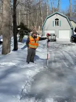
Land Surveying
Civil Engineering
Wetlands Delineation
Boundary Surveys
Permitting Services
Topographic Mapping
Infrastructure Design
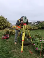
Hydrographic Surveys
Stormwater Management
Federal Permitting
Details
- Year established: 1992
Highlights and features
- 40+ years of combined leadership experience in civil engineering and surveying
- Multi-disciplinary team with specialized expertise in federal/state permitting
- Proven project management process with quality control at every stage
- Licensed professionals in multiple engineering and surveying disciplines
- Recognized experts in complex boundary resolution and topographic mapping
Associations and certifications
- Professional Engineers licensed in Maine
- Professional Land Surveyors licensed in Maine
- Army Corps of Engineers Wetlands Delineation Certification
Services
Land Surveying
Our land surveying division conducts precise boundary, topographic, and ALTA/NSPS surveys using advanced GPS technology. We deliver detailed site analysis for property development, utility projects, and legal documentation. Services include FEMA elevation certificates, subsurface utility detection, and hydrographic surveys for coastal properties.
Civil Engineering
We provide comprehensive civil engineering solutions including stormwater management systems, roadway design, and sewer infrastructure planning. Our team specializes in creating site-specific designs that balance regulatory requirements with practical construction considerations for residential and commercial developments.
Wetlands Delineation
Certified by the Army Corps of Engineers, our wetlands specialists identify and map jurisdictional wetlands to support development projects. We prepare mitigation plans and permitting packages that comply with federal and state environmental regulations while minimizing project impacts.
Boundary Surveys
Our licensed surveyors perform detailed boundary resolution using historical deed research and modern surveying techniques. We create legally defensible property maps for real estate transactions, land development, and dispute resolution with precise GPS data collection.
Federal Permitting
We navigate complex federal permitting requirements for projects involving wetlands, waterways, and coastal zones. Our team prepares technical documentation and coordinates with agencies like the Army Corps of Engineers to secure necessary approvals efficiently.
People
Troy McDonald
President, PLS
40+ years of experience in land surveying and civil engineering. Former telephony surveying firm owner. Licensed Professional Land Surveyor in Maine overseeing daily operations and business development.
Alex Frederick
Director of Survey
10 years of land surveying expertise specializing in boundary resolution and fieldwork. Managing survey operations while pursuing Professional Land Surveyor licensure in Maine.
Jim Fisher
Senior Associate
Oxford-educated expert in permitting processes and municipal presentations. Army Corps-certified wetlands delineator with academic background in business and environmental regulations.
Connor Bourassa
Permitting Specialist
Specializes in regulatory compliance documentation and environmental permitting processes for complex development projects requiring federal and state approvals.
Jeremy Vieu
Project Surveyor
Experienced field surveyor conducting boundary surveys, topographic mapping, and GPS data collection for infrastructure and land development projects across northern New England.
Questions
What geographic areas do you serve?
We operate throughout New England, including Maine, New Hampshire, Vermont, and Massachusetts, with primary operations based in Scarborough, Maine.
What surveying certifications do your staff hold?
Our team includes Professional Land Surveyors licensed in Maine and Army Corps of Engineers-certified wetlands delineators, ensuring compliance with federal and state standards.
What engineering specialties do you offer?
We provide civil engineering services including stormwater management, shoreline stabilization, sewer system design, and hydrological modeling for residential and commercial developments.
How does your project management process work?
Each project receives a dedicated manager who coordinates surveying, design, and permitting phases while maintaining direct client communication throughout the project lifecycle.
What permitting services do you provide?
We handle local, state, and federal permitting requirements including wetlands mitigation plans, erosion control documentation, and municipal zoning compliance submissions.