Business Details
21 Years
experience
Expert Civil Engineering & Land Surveying Services
Founded in 2005 by Rosanne Frandina, PE, LS, Frandina Engineering & Land Surveying, PC has built on a legacy of engineering excellence dating back to 1976. Our firm combines over four decades of technical expertise with cutting-edge technology to deliver precise land surveying and civil engineering solutions. We specialize in boundary surveys, topographic mapping, and construction stakeout for complex infrastructure projects across Western New York. Our team of licensed professionals brings decades of combined experience from notable projects including the Niagara Falls International Airport and Buffalo Waterfront developments. Certified as a Women Business Enterprise (WBE) and Disadvantaged Business Enterprise (DBE), we maintain rigorous standards of quality control through advanced data collection methods and AutoCAD documentation.Our commitment to technical accuracy is matched by our dedication to client collaboration, ensuring projects remain on schedule and within budget. With deep roots in the engineering community, our staff includes seasoned surveyors who have worked on some of the region's most significant public works initiatives. We maintain active certifications with multiple government agencies including the Niagara Frontier Transportation Authority and State University Construction Fund. Our technical capabilities are demonstrated through major projects like the Seneca Nation Buffalo Creek Casino and Erie County Medical Center expansions. Through continuous investment in modern surveying equipment and staff development, we provide reliable solutions that meet evolving industry standards while upholding the family values established by our founder.
Services
Land Surveying
Boundary Surveys
Topographic Surveys
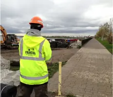
Construction Stake-Out
As-Built Surveys
Highway Design Surveys
Airport Surveys
FEMA Flood Certificates
Easement Determination
Right of Way Acquisitions
Details
- Year established: 2005
Highlights and features
- We have over 40 years of experience in civil engineering and land surveying
- Our team includes licensed Professional Engineers and Land Surveyors
- We are certified by multiple government entities including the State of New York
- Our staff has worked on major regional projects like the Buffalo Waterfront development
- We utilize cutting-edge data collection technology for maximum accuracy
Associations and certifications
- Women Business Enterprise (WBE)
- Disadvantaged Business Enterprise (DBE)
Services
Land Surveying
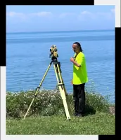
Our comprehensive land surveying services provide precise measurements for property boundaries, topographic features, and construction layouts. Utilizing advanced GPS technology and AutoCAD documentation, we ensure accuracy for both small and large-scale projects. Clients benefit from our team's decades of experience with major infrastructure developments.
Boundary Surveys
Accurate boundary determination services help resolve property disputes and prepare for development. Our licensed surveyors use modern equipment to locate existing boundaries and provide legal documentation. Clients gain clear property definitions essential for real estate transactions and construction planning.
Topographic Surveys
Detailed terrain mapping services capture elevation changes and natural features for engineering and construction purposes. Our surveys support site planning, drainage analysis, and infrastructure design. Clients receive precise digital documentation suitable for municipal submissions and engineering calculations.
Construction Stake-Out
Precise construction layout services ensure accurate implementation of engineering plans. Our team marks building locations, utilities, and grading points to guide construction crews. Clients benefit from reduced rework and compliance with project specifications through our quality control process.
Airport Surveys
Specialized surveying for aviation infrastructure including runway alignment and terminal expansions. Our firm has completed projects at major regional airports like Niagara Falls International. Clients receive FAA-compliant documentation and precise measurements critical for aviation safety and operations.
People
Rosanne Frandina
President & Project Manager
Licensed Professional Engineer and Land Surveyor with over 40 years of experience. Oversees project management and engineering-survey coordination. Recipient of multiple industry awards, previously held senior positions at Buffalo City Hall.
Mark Childs
Professional Land Surveyor
Licensed Land Surveyor with 40+ years of experience. Expert in AutoCAD drawing and field surveying. Former surveyor with Deborah A. Naybor, LS, PC. Provides technical expertise for complex mapping projects across Western New York.
Corey Mitchell
Survey Crew Chief
Certified OSHA safety trainer with 30+ years of field experience. Specializes in boundary surveys, construction layout, and GPS technology. Manages daily survey operations while ensuring compliance with industry standards and safety protocols.
Eric Zimmerman
Survey Instrument Operator
Experienced field technician with 20+ years in data collection. Certified in OSHA safety standards. Works closely with crew chief to maintain precision in survey measurements and ensure quality control in field operations.
Questions
What surveying services do you offer?
We provide boundary surveys, topographic mapping, construction stakeout, airport surveys, FEMA flood certificates, easement determination, and highway design surveys throughout Western New York.
Are you certified as a woman-owned business?
Yes, we are certified as both a Women Business Enterprise (WBE) and Disadvantaged Business Enterprise (DBE) with the State of New York and multiple local agencies.
What experience do you have with infrastructure projects?
Our team has worked on major regional projects including Buffalo Niagara Airport improvements, Light Rail Rapid Transit System, Erie County Medical Center expansions, and Seneca Nation Buffalo Creek Casino developments.
How do you ensure survey accuracy?
We use modern GPS technology and AutoCAD documentation combined with licensed professionals' oversight to maintain precise measurements and quality control standards.
What areas do you serve?
We primarily serve Western New York including Buffalo, Niagara Falls, Erie County, and surrounding regions for all our engineering and surveying services.