Business Details
50+ Years
experience
Your Trusted Civil Engineering Partner in Louisiana
Since 1964, J.V. Burkes & Associates has been a trusted leader in civil engineering, land surveying, and environmental consulting across Southeast Louisiana and the Mississippi Gulf Coast. Founded by J.V. Burkes, our firm has grown into a multi-disciplinary team led by siblings Sean Burkes and Barbara Zelenka, who continue our mission of delivering tailored solutions for commercial, residential, and public sector clients. With over 50 years of experience, we specialize in drainage design, traffic engineering, wetland permitting, and elevation certification, supported by an extensive archive of historical land records unavailable elsewhere. Our team of certified professionals combines deep local expertise with cutting-edge technology to address complex challenges in site development, infrastructure planning, and environmental compliance. We maintain a client-centric approach, prioritizing transparent communication and practical solutions that balance budgetary constraints with regulatory requirements.Our track record includes over 40,000 land surveys and engineering designs for projects ranging from small subdivisions to million-square-foot facilities. Recognized for our technical excellence and community commitment, we serve as trusted advisors to developers, government agencies, and property owners navigating the unique geographical challenges of the Gulf Coast region. Our dedication to continuing education ensures we remain at the forefront of industry standards in civil design, traffic modeling, and environmental stewardship. Through strategic planning and meticulous attention to detail, we help clients transform development concepts into reality while maintaining compliance with federal, state, and local regulations. This combination of experience, technical proficiency, and personalized service has earned us enduring client relationships and industry recognition as a premier engineering firm in the Southeastern United States.
Services
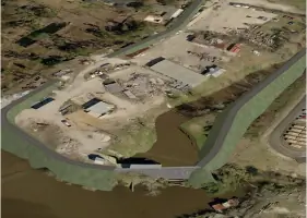
Civil Engineering
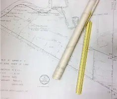
Land Surveying
Traffic Engineering
Environmental Consulting
Elevation Certificates
Drainage Design
Wetland Permitting
Site Development
Construction Inspection
LED Certification
Details
- Year established: 1964
Highlights and features
- We offer 50+ years of Gulf Coast engineering expertise
- Our team maintains exclusive historical land records database
- Multi-disciplinary services cover entire project lifecycle
- Proven track record with 40,000+ completed land surveys
- Leadership team with generational continuity since 1964
What people say
Critical partner for coastal projects
Accurate surveys exceeded expectations
Major expansion success
Million square foot facility
Deep local expertise
Services
Civil Engineering
Our civil engineering team delivers comprehensive solutions for drainage systems, water modeling, sewer design, and roadway infrastructure. We create customized plans for commercial developments, residential projects, and public works that meet regulatory standards while optimizing functionality. With expertise in LED Site Certification and construction bid coordination, we ensure projects progress smoothly from concept to completion.
Land Surveying
We perform precise land surveys for subdivisions, property transfers, and development projects. Our surveyors utilize advanced technology to create accurate boundary determinations, topographic maps, and ALTA/ACSM surveys. With over 40,000 completed surveys and access to exclusive historical records, we provide reliable data for informed land use decisions.
Traffic Engineering
Our traffic engineering services include traffic impact studies, roundabout design, and roadway improvement plans. We develop practical solutions for traffic signal design, access management, and parking lot optimization. By analyzing traffic patterns and regulatory requirements, we create efficient transportation systems that enhance safety and mobility.
Environmental Consulting
We specialize in environmental permitting for wetlands and Waters of the U.S. Our consultants provide delineation services, mitigation planning, and compliance strategies for development projects. With 25 years of experience navigating federal and state regulations, we help clients achieve environmental compliance while maintaining project timelines and budgets.
Elevation Certificates
Our elevation survey services determine property flood risk by measuring building elevations relative to flood maps. We provide certified documentation for flood insurance requirements and development permits. This critical information helps property owners understand flood risks and make informed decisions about floodplain management.
People
Sean Burkes
President
As third-generation leader of J.V. Burkes & Associates, Sean Burkes oversees operations with 25+ years of engineering experience. He specializes in strategic project planning and client relations, maintaining the firm's commitment to technical excellence and community service in Southeast Louisiana.
Barbara Zelenka
Vice President
Barbara Zelenka brings 30 years of civil engineering expertise to her leadership role at J.V. Burkes & Associates. She focuses on environmental compliance and survey operations, ensuring the firm's technical excellence while maintaining the family-owned business values established by her father, J.V. Burkes.
Questions
What engineering services do you offer?
We provide civil engineering services including drainage design, roadway planning, sewer/water systems, construction inspection, and LED Site Certification for commercial, residential, and public projects.
How does your surveying experience benefit clients?
With over 40,000 completed surveys and exclusive historical records, we deliver accurate boundary determinations, topographic mapping, and ALTA/ACSM surveys that streamline development processes.
Do you handle environmental permitting?
Yes, we specialize in wetland delineation, Waters of the U.S. permitting, and mitigation planning for developments across Southeast Louisiana and Mississippi Gulf Coast.
What are elevation certificates used for?
Elevation certificates document building elevations relative to flood maps, helping property owners determine flood risk and meet insurance requirements for floodplain management.
Reviews (5)
Are You Are You Luis
May 10, 2021
Report
The lady that answered the phone is extremely rude when I told her that I've put in a spot request on a house a week ago she laughed and said they are three weeks behind first of all they should never engage in surveying for new construction if they can't provide a service on a timely manner no one could sit there and wait for three weeks to get a spot check pathetic
Rachel Massey
May 06, 2021
Report
Every interaction with this firm has been a hassle. Each time we turn around it's ordering another form that they "already have measurements for", another grossly underestimated wait time, and another few hundred dollars for additional services. The blatant lack of professionalism and general indifference to client needs and time frames has made moving to the area a deeply unpleasant experience. JVB has dragged the process out to the point that building permits we applied for in 2019 are about to expire. At this point, I would never recommend using this firm for any kind of services.
Amber T.
Dec 12, 2020
Report
Critical: Professionalism, Quality, Responsiveness I have gotten nothing but the run around. Tried having a spot check done. Was told there is already a house on the property. When I can't build until spot check is done You can never get a call back! Very unprofessional. Have been paid in full for months while I am still waiting for the work to be finished.
Eric Delaughter
Nov 23, 2019
Report
Had their team come out and mark some property lines for me and they were quick and efficient! Very pleased with the service!
Lauren Renwick
Apr 18, 2017
Report
Consistent expertise from a well-established local civil engineering firm. They are true solution providers.