Business Details
35 Years
experience
Expert Construction Monitoring & Geotechnical Services
Municon Consultants has been a trusted partner in construction monitoring and geotechnical services since 1991. Our expertise lies in deploying advanced technologies such as smart sensors, UAV drones, and 3D lidar scanners to deliver real-time, actionable data that safeguards projects against risks. With a legacy built on 30+ years of innovation, we specialize in creating digital twins and comprehensive monitoring programs tailored to complex infrastructure projects.Our team of seasoned professionals collaborates with general contractors, municipalities, and stakeholders to ensure project success through precision engineering and data-driven insights. Headquartered in San Francisco, with offices in Vancouver and Bellingham, we serve the entire US and Canadian West Coast, maintaining the same high standards established by our predecessor, Municon Consultants.
Services
Remote Monitoring
Geophysics
3D Site Surveys
Non-Destructive Testing
Crack Monitoring
Drone Documentation
Dust Monitoring
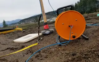
Groundwater Monitoring
Sound Monitoring
Vibration Monitoring
Details
- Year established: 1991
Highlights and features
- We have over 30 years of specialized experience in construction monitoring
- We deploy advanced technologies like 3D lidar and drone documentation
- We provide real-time data for proactive project risk management
- We serve major infrastructure projects across the West Coast
- We maintain continuous service standards since 1991
Services
Remote Monitoring
Our remote monitoring systems provide continuous data collection for construction sites using IoT-enabled sensors. This technology tracks structural movements, environmental impacts, and project progress in real time. Clients receive immediate alerts and detailed analytics to prevent potential failures and ensure safety compliance.
Geophysics
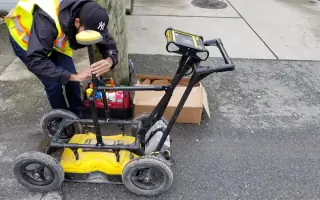
We employ geophysical methods to create detailed underground models for infrastructure planning. Techniques include MASW seismic surveys and utility locating to map subsurface conditions. This data supports foundation design and excavation planning while minimizing unexpected ground risks.
3D Site Surveys
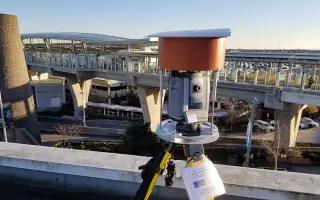
Using lidar scanning and drone photogrammetry, we generate accurate 3D site models for project documentation. These digital twins enable virtual site navigation and precise before/after comparisons. The technology supports quality control and dispute resolution through verifiable visual records.
Non-Destructive Testing
Our non-destructive testing services assess concrete integrity and structural health without damaging materials. Methods include crosshole sonic logging and thermal profiling to detect internal flaws. These evaluations ensure structural safety while maintaining existing infrastructure integrity.
Crack Monitoring
We implement precision crack monitoring systems to track structural movements over time. Our documentation includes photographic records and dimensional measurements of surface defects. This service protects stakeholders by providing objective evidence of pre-existing and developing structural conditions.
Questions
What services does Municon West Coast offer?
We provide remote monitoring, geophysical surveys, 3D site documentation, crack monitoring, and environmental monitoring for construction projects.
What areas do you serve?
We operate across the US and Canadian West Coast, including California, British Columbia, and Washington State.
What technology do you use?
We utilize smart sensors, UAV drones, 3D lidar scanners, and real-time data platforms for comprehensive project monitoring.
How do you help construction projects?
Our services prevent damage, reduce legal risks, and enable data-driven decisions through precise condition documentation and analysis.
What project types do you handle?
We work on highways, tunnels, bridges, excavations, dams, and other infrastructure projects requiring specialized monitoring.